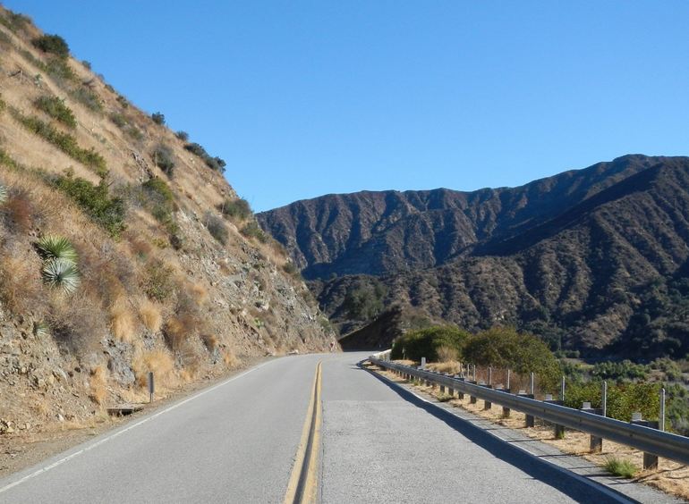
San Gabriel Canyon Road Trip: Stops Along Highway 39
California State Route 39 once ran from Pacific Coast Highway in Huntington Beach to Angeles Crest Highway at Islip Saddle. Most drivers know the southern stretch as Beach Boulevard and Azusa Avenue. The mountain section is another road entirely: San Gabriel Canyon Road, a winding two-lane climb that leaves the San Gabriel Valley and rises more than 5,000 feet into Angeles National Forest.
This road trip starts at the San Gabriel Canyon Gateway Center in Azusa and ends at Crystal Lake Recreation Area. The drive itself is only about 25 miles, but that number hides a full day of reservoirs, river forks, abandoned highway projects, hiking trailheads, and one of the few natural lakes in the San Gabriel Mountains. Give yourself time. The lower canyon fills early on hot weekends, parking lots overflow, and several of the best stops sit on side roads that deserve more than a glance from the car.
Spring and fall are the easiest seasons. Summer brings relief from valley heat, along with heavy crowds in the first few miles of the river. Winter can close or slow the upper road after storms. Before you go, check Caltrans and Angeles National Forest alerts. There is no gas, little cell service, and almost no shade once you leave the lower canyon.
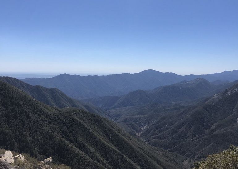
Start at the San Gabriel Canyon Gateway Center
Buy your National Forest Adventure Pass before you climb into the canyon. The Gateway Center sits at the mouth of San Gabriel Canyon and is the simplest first stop. A daily pass costs $5. An annual pass is $30. An America the Beautiful interagency pass also covers developed day-use parking.
You need a pass if you park at developed day-use sites with amenities such as restrooms, picnic tables, and trash service. An automated fee machine at the Gateway Center takes debit or credit cards. It does not take cash. Display the pass on your dashboard and keep it visible at every stop. Ticketing is common on busy days, especially along East Fork Road and at West Fork.
This is also a good place to confirm current fire restrictions, road conditions, and whether Crystal Lake Campground loops are open. Fill your tank in Azusa. There are no fuel or charging stations once you enter the forest.
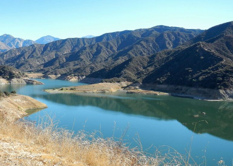
Morris Reservoir Dam
A few miles up the canyon, Morris Reservoir Dam appears on the right. The dam was completed in 1934 for flood control on the San Gabriel River. No one can access the dam or the reservoir, but several pullouts give you a clear view of the concrete face and the water behind it.
This area has a quieter chapter that most drivers miss. During World War II, Morris Reservoir served as a U.S. Navy weapons test site. Crews used the deep water to test torpedoes. Today the overlooks are brief, safe stops if traffic allows. Pull completely off the pavement. This stretch of Highway 39 is narrow, and weekend traffic moves faster than the curves suggest.
San Gabriel Dam
Just up-canyon stands San Gabriel Dam, a 500-foot-high wall that holds back San Gabriel Reservoir. The reservoir stores water for groundwater recharge in the San Gabriel Valley, helps control flood flows, and feeds a small hydroelectric plant. Like Morris, the dam and reservoir are closed to the public.
The overlooks here are worth the pause. From the highway, you can see how the canyon tightens and how much of this landscape is working infrastructure, not only scenery. After winter storms, water levels and sediment operations can change the reservoir’s look from week to week. Stay behind barriers and use signed pullouts only.
East Fork Road and Heaton Flats
At the upstream end of San Gabriel Reservoir, East Fork Road turns off Highway 39 and follows the East Fork of the San Gabriel River for about five miles. The pavement ends at the Heaton Flats day-use area and trail camp, one of the range’s busiest trailheads.
East Fork Road provides access to two of the canyon’s most unusual walks: the Bridge to Nowhere Trail and Shoemaker Canyon Road, often called the Road to Nowhere. Arrive early. The lot at the East Fork trailhead fills fast on weekends, and parking along the road can earn a ticket. An Adventure Pass or interagency pass is required.
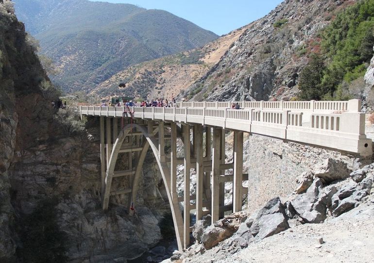
Hike to the Bridge to Nowhere
The Bridge to Nowhere is a 1936 concrete arch standing over the East Fork with no road on either side. It was built as part of a planned highway through the canyon toward Wrightwood. A major flood in 1938 wrecked the approaches, and the project was abandoned. The bridge was left in the wilderness.
The hike is about 10 miles round trip from the East Fork / Heaton Flats trailhead, with roughly 900 to 1,200 feet of elevation gain depending on the route you follow. Expect several river crossings. After rain or during spring snowmelt, those crossings can be deep or unsafe. Wear shoes you can get wet. Carry more water than you think you need. Cell service drops out quickly.
The trail enters Sheep Mountain Wilderness. A free self-issue wilderness permit is available at the trailhead kiosk. On weekends, Bungee America leads groups to the bridge for jumps from the span, the only regular commercial bungee operation of its kind in California. For a quieter walk, start at sunrise on a weekday.
Gold Along the East Fork
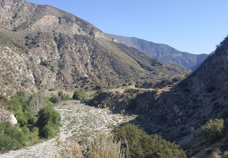
The East Fork had its own gold rush in the mid-1800s. Mining camps such as Prospect Bar and Eldoradoville sprang up along the river. Most of the easy placer gold was taken within a few years, and the camps faded. Floods later erased much of what remained.
Recreational panners still work the gravel bars and come away with a few flakes on a good day. If you try it, stay on public land, pack out everything you bring, and leave the riverbed as you found it. The East Fork is also habitat, not only a historic ditch. Treat the water before drinking it.
Shoemaker Canyon Road, the Road to Nowhere
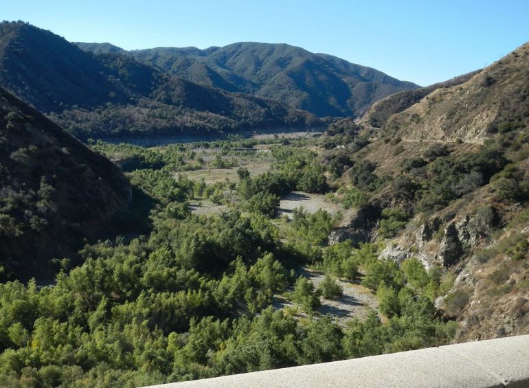
Shoemaker Canyon Road branches off East Fork Road and tells a different story of an unfinished highway. In the 1950s, officials wanted an escape route from the Los Angeles Basin toward the desert in case of nuclear attack. Construction began in 1956. County inmates did much of the labor. After about four miles of road and two tunnels, funding and public support ran out. Work stopped in 1969.
You can drive a short paved section to a locked gate, then walk or ride the graded road through two dark tunnels before the alignment ends on a steep mountainside. Compared with the Bridge to Nowhere, far fewer people take this route. There is little shade outside the tunnels, so this is a poor midday summer hike. Bring a light for the tunnel interiors.
San Gabriel Canyon OHV Area
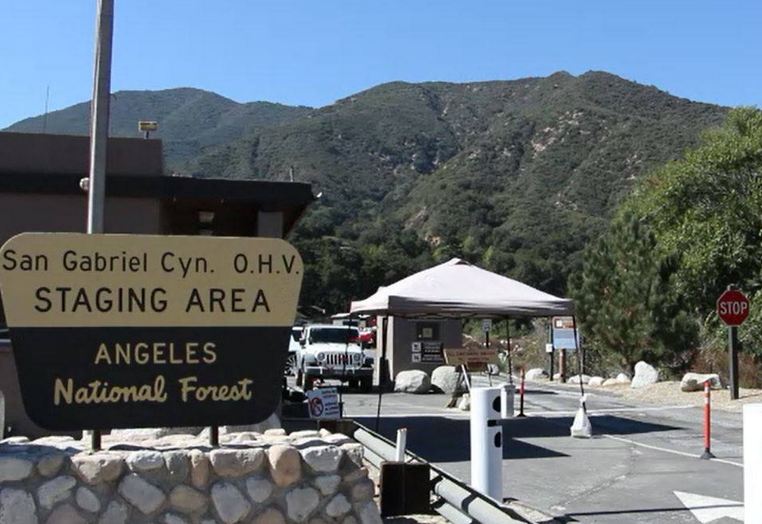
About half a mile past the East Fork turnoff, the San Gabriel Canyon Off-Highway Vehicle Area occupies roughly 160 acres of river bottom. The terrain is sand, rock, mud, and shallow crossings. It is open to two-, three-, and four-wheeled OHVs on Saturdays, Sundays, and major holidays, generally from 8 a.m. to 4 p.m., with all vehicles out of the area by 4:30 p.m.
Reservations are required in advance through Recreation.gov. Print or screenshot your QR code before you leave town. Cell service is unreliable at the entrance. Alcohol is prohibited. Street-legal and OHV rules both apply, including spark arrestors and current registration. After storms or dam sediment work, the Forest Service may limit the area to high-clearance four-wheel-drive vehicles or shrink the riding boundaries. Confirm the current map before you trailer anything up the canyon.
The nearest gas and towing are back in Azusa. Camp Williams, on the East Fork, is the closest food stop for many riders.
West Fork Day-Use Trailhead
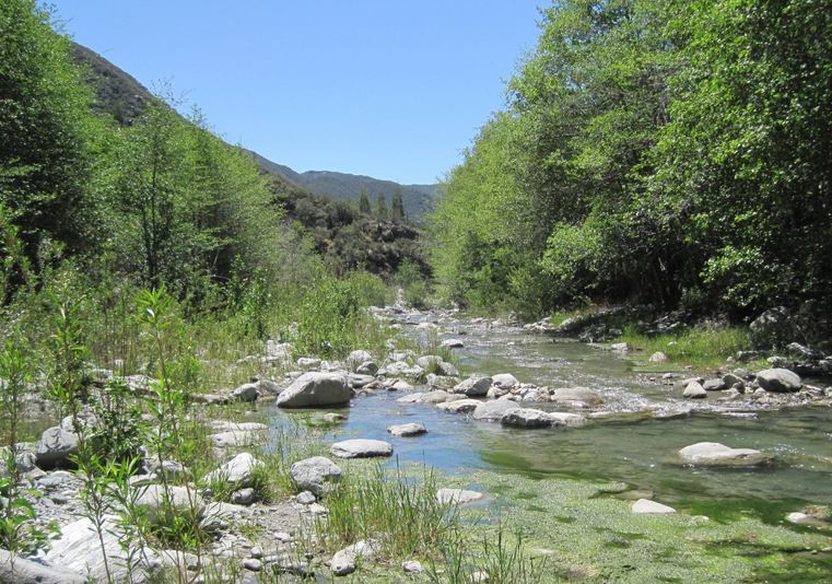
If motors are not the plan, the West Fork of the San Gabriel River is the gentlest long walk on this drive. From the West Fork parking area on Highway 39, a paved service road follows the river toward Cogswell Reservoir. Most people treat it as a 13- to 16-mile round trip if they go all the way to the dam, with modest elevation gain until the final approach.
Hikers, runners, and cyclists share the route. Picnic tables and vault toilets line the trail. The West Fork is a designated wild trout stream in places, with catch-and-release rules on some stretches. In summer, the first mile of creek is packed with people cooling off. An Adventure Pass is required to park.
Bring drinking water. There is none on the trail. After storms, small waterfalls spill down the south-facing slopes. Early morning is quieter and cooler than midday.
Highway 39 Along the North Fork
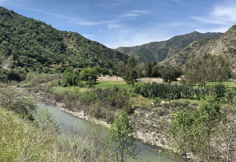
Past the West Fork lot, Highway 39 leaves the broad lower canyon and begins to climb in earnest beside the North Fork. The road narrows. Curves tighten. The river drops away, then returns. This is the stretch motorcyclists and cyclists talk about: continuous elevation gain, limited shoulders, and long views when the trees open.
Trailheads appear without much warning. Bichota Canyon Trail, Pigeon Ridge Fire Road, Upper Bear Creek Trail, and the short walk to Lewis Falls all leave from or near the highway. Elizabeth’s Spring sometimes runs on the mountainside near Lewis Falls. In spring, monkeyflower and other native blooms show up in the road cuts and overflow lots, including areas near the Devil’s Canyon Dam Truck Trail and Coldbrook Campground.
Watch for rockfall, cyclists, and cars swinging wide on blind corners. There are turnouts. Use them instead of stopping in the lane for photos.
Crystal Lake Recreation Area
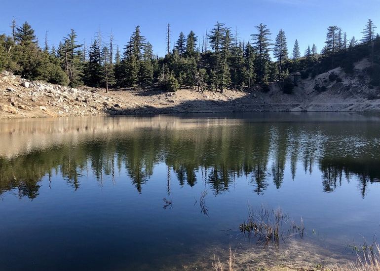
Crystal Lake Recreation Area is the turnaround for almost everyone who drives Highway 39. The recreation area sits near 5,539 feet. Crystal Lake itself is a small, snow- and spring-fed lake formed long ago by a landslide. It is one of only two natural lakes in the San Gabriel Mountains. The Forest Service occasionally stocks it with trout. Swimming is not allowed. Motorized boats are not allowed.
The campground is the largest developed camping area in this part of the range, with sites spread across paved loops. Counts published by different agencies vary, but the Forest Service currently describes about 120 sites across loops A, B, C, D, E, and I. Sites are first-come, first-served. Expect picnic tables, fire rings, and vault toilets. Potable water is seasonal. Maximum trailer length is about 22 feet, and there are no hookups. A California campfire permit may be required when fires are allowed.
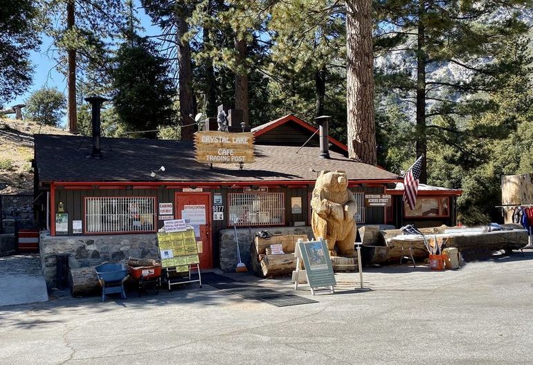
Crystal Lake Cafe & Trading Post sells simple meals, snacks, and camping supplies, including firewood. Hours vary by season; it is often closed on Tuesdays. A small visitor center, staffed by volunteers on weekends, sells Adventure Passes (cash only, per the last report) and can answer trail questions. The lake is a short walk from the campground and nearby parking, roughly a mile or less depending on where you leave the car.
From here, trails continue toward Windy Gap and Mount Islip for anyone who still has legs after the drive: no cell service and no fuel. Plan the return before the light fades.
The Closed Road Beyond Crystal Lake
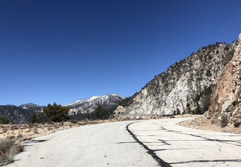
About a quarter mile past the Crystal Lake turnoff, a gate ends Highway 39 for the public. The last 4.5 miles toward Angeles Crest Highway at Islip Saddle have been closed since a major rockslide in 1978. Later slides, including damage in 2005, kept the road shut. Caltrans still maintains the alignment for fire crews and other emergency traffic. It is not a hiking destination, and walking around the gate is not a legal through-route.
That closure is why Crystal Lake feels like the end of the line. Highway 39 was designed to punch straight through the range. The mountain refused to cooperate. The drive you just finished is the part that survived.
Know Before You Go
From the Gateway Center to Crystal Lake, budget at least half a day, and a full day if you add East Fork or West Fork. Buy the $5 Adventure Pass. Pack layers. The lower canyon can be hot, while Crystal Lake stays cool. Carry water, a paper map or offline download, and a full tank.
San Gabriel Canyon is one of the easiest mountain escapes from the Los Angeles basin, which is why it packs out on summer weekends. If you want river access without a crowd, go on a weekday. If you want the high country, keep driving until the pines take over and the air thins. Then turn around at the gate, descend the same curves you climbed, and remember that the “end” of Highway 39 is only the end for cars.
Highway 39 rewards a slow drive more than a fast one. Stop at the dams, walk a mile of river, and save daylight for Crystal Lake. The canyon is close to the city, but the weather, the road, and the crowds change by the hour. Check conditions, carry what you need, and give the mountain the extra time it asks for.
Discover more from Daytrippen.com
Subscribe to get the latest posts sent to your email.