- 113
- 124shares
- Like
- X
- Digg
- Tumblr
- VKontakte
- Buffer
- Love This
- Odnoklassniki
- Meneame
- Blogger
- Amazon
- Yahoo Mail
- Gmail
- AOL
- Newsvine
- HackerNews
- Evernote
- MySpace
- Mail.ru
- Viadeo
- Line
- Comments
- SMS
- Viber
- Telegram
- Subscribe
- Facebook Messenger
- Kakao
- LiveJournal
- Yammer
- Edgar
- Fintel
- Mix
- Instapaper
- Copy Link
California Route 74, or Ortega Highway, is a scenic road extending just over 21 miles from San Juan Capistrano to the Lake Elsinore Valley. Its history begins as a Native American footpath along San Juan Creek. Construction of the two-lane highway by the State of California, along with Orange and Riverside Counties, started in 1929 and was completed in 1933. The road, originally called the Elsinore-San Juan Capistrano Highway-to-the-Sea, is now well-traveled. Traffic can be relatively heavy, especially on weekdays, as it accommodates commuters traveling between Orange County and the Inland Empire.
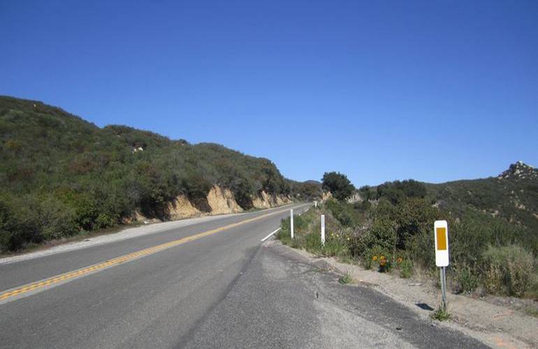
Ortega Highway has many tight turns and elevation changes, making it popular among sports bikes and car enthusiasts. The speed limit will typically be 55, but for those who want to enjoy the scenery, numerous turnouts can be used for taking breaks and pictures. Before you begin, make sure you have enough gas to reach Lake Elsinore since there is essentially only wilderness in between. Here are some popular stops along the highway for you to explore.
Starting Point: San Juan Capistrano, California
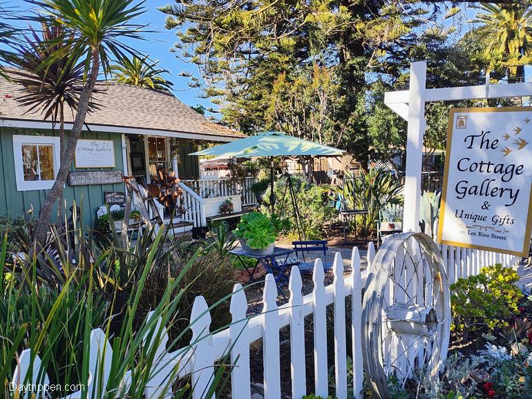
We’ll begin our road trip in the oldest neighborhood in California, located near the town’s historic mission—the Los Rios Historic District. Settled in the late 1700s during the Mission San Juan Capistrano construction, Los Rios is near the corner of Ortega Hwy and Camino Capistrano. After crossing the 405 freeway, Ortega winds through about three miles of suburbia before the road crosses San Juan Creek and escapes into the backcountry. The route takes you through beautiful rolling hills until it climbs into the Cleveland National Forest.
Ronald A. Caspers Wilderness Park
Your first stop is about an eight-mile drive, an excellent place for hiking, camping, picnicking, horseback riding, mountain biking, photography, and wildlife viewing. This park has a campground, a vast playground with picnic tables, and numerous trails offering a multitude of altitudes and inclines throughout the scrub and riparian landscapes. It is also an excellent spot for viewing the abundance of migratory birds that frequent the park in spring and fall. Upon arrival, guests will want to stop by the Interpretive Center for more information on the trails and wildlife and some educational and exciting displays on the park website.
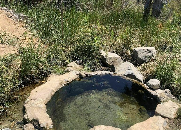
Ortega Hot Springs (San Juan Hot Springs)
Back onto Ortega Highway, another five miles takes you to the Ortega Hot Springs. The now-closed hot springs are located just off the Ortega Highway as it enters the western boundary of the Cleveland National Forest. For those wishing to explore, there are a couple of primitive in-ground hot springs that can be reached by hiking from Caspers Wilderness Park. The area is secluded, and emergency services are nearly an hour away, so be careful. If you visit, respect the private property around the springs and the natural environment.
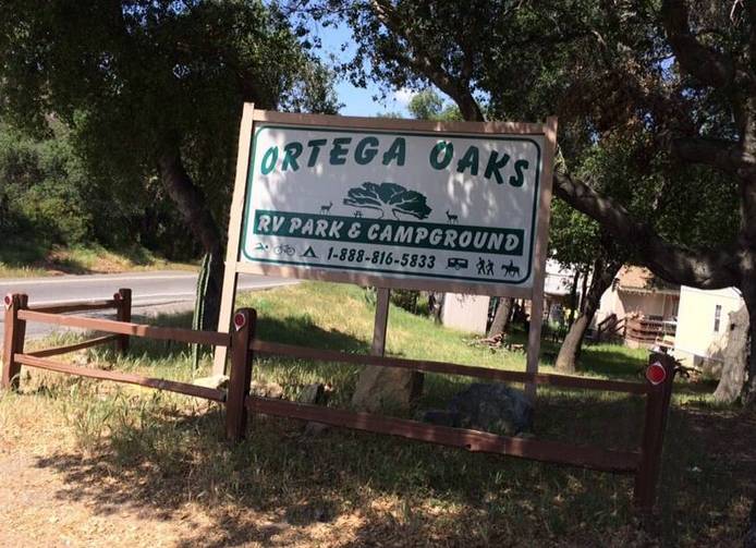
Ortega Oaks Campground Ortega Highway
Back out on Ortega Highway, the route narrows and heads up into the mountains through a particularly twisty section. Extreme care must be taken when traveling in this section. Headlights must be turned on while climbing up through the canyon. After 14 miles of twists and turns, you arrive at Ortega Oaks campground with its adorable little shop. The Campground offers tent and RV sites with full hookups, including satellite television and electricity. An outdoor swimming pool, hiking, and horse trails lead from the Campground. Campground website.
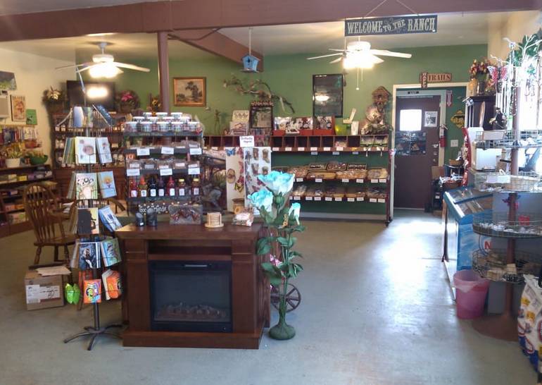
Ortega Oaks Candy Store
Ortega Oaks Candy Store. For nearly 40 years, the store has been selling confections to satisfy even the most severe sweet tooth. When entering, patrons will be greeted with the most amazing smells that will take them back to their childhood. You find various hand-made delights, including dark or milk chocolate-covered honeycomb, Snickerdoodle cookies, and peanut butter cups. Loaded up on a myriad of goodies, you’re on the final leg of the Ortega Highway road trip.
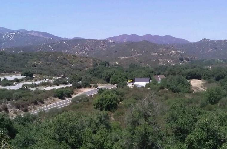
El Cariso Village Ortega Highway
A quick three-mile trip takes you to the small village of El Cariso, located at the crest of the Santa Ana Mountains. Historically, El Cariso served as a hideout for an outlaw gang of horse rustlers. In 1857, a shootout occurred between the gang and a large posse, resulting in the death or capture of the outlaws. In the village, you can find Hafey Farms Country Store, which offers a variety of fresh and locally made products. Their selection includes exotic wild game and beef jerky, fresh deli sandwiches, camping supplies, and unique gifts—Hafey Farms website.
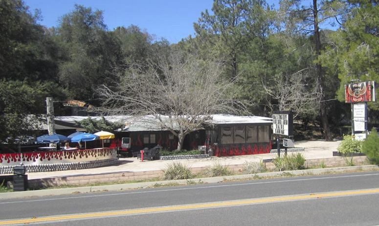
Biker Bar Hell’s Kitchen Highway 74
Hell’s Kitchen was permanently closed after a fire gutted the restaurant’s Kitchen. The eatery was popular with bikers on the weekends and road trippers during the week. The restaurant featured indoor and outdoor dining, a coffin condiment bar, beer, wine, and good old American-style food. The building is still there and has been for sale for several years; however, the iconic Hell’s Kitchen sign is no longer there, but Hell’s Kitchen Motorsports Bar & Grill is down the hill at 530 Crane St, Lake Elsinore, California.
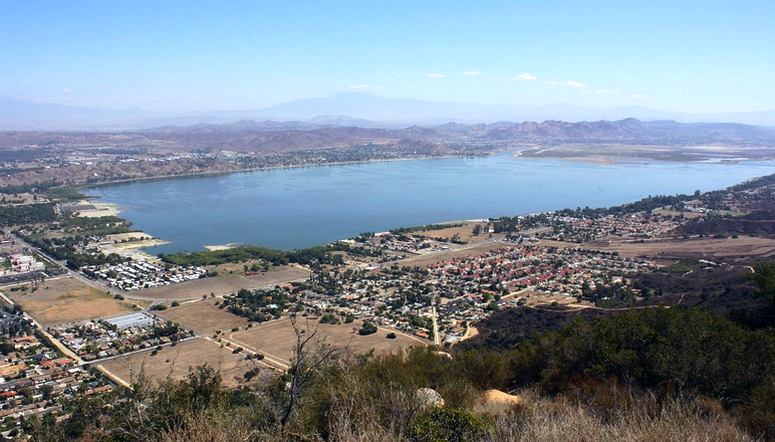
Lookout Roadhouse Highway 74: Million Dollar View
Your final stop is Lookout Road House, which offers a spectacular view of Lake Elsinore, the largest natural freshwater lake in Southern California, with 3,300 surface acres and over 14 miles of shoreline. Lookout Roadhouse serves country-style breakfast and lunch, along with cold beer. You can dine inside or out in the wind on the patio. You can return to the San Juan Capistrano or Lake Elsinore—Roadhouse website.
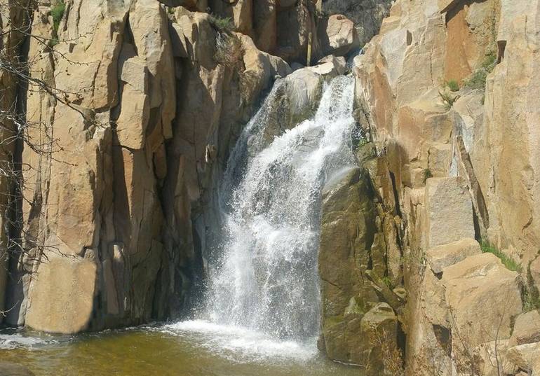
Ortega Falls, Cleveland National Forest
One final stop before reaching Lake Elsinore overlook is Ortega Falls. Most of the time, the falls are a trickle, but after a rainstorm, the falls can be spectacular. Ortega Falls is a steep but easy half-mile hike from the highway. The falls are located at mile 21 from San Juan Capistrano. There is a small parking lot off the street. Unfortunately, being so close to the road, the falls suffer from graffiti and litter that spoil the region’s beauty.
Final Stop: Lake Elsinore, California
Visitors to Lake Elsinore will discover plenty of opportunities for outdoor recreation, top-notch shopping outlets, antique shops, fine restaurants, and even a professional baseball stadium. So the next time you’re looking for that perfect day trip, load up the family, fill up the gas tank, and head down Ortega Highway for a good old-fashioned American road trip.
Ortega Highway is renowned for its scenic beauty and historical significance, serving as a direct route that connects coastal Orange County to the Inland Empire. It is particularly popular among motorcyclists because its winding roads offer spectacular views. However, these characteristics also contribute to its reputation as one of California’s more dangerous highways.
Southern California Road Trips
Bring Along an Emergency Survival Kit
- 113
- 124shares
- Like
- X
- Digg
- Tumblr
- VKontakte
- Buffer
- Love This
- Odnoklassniki
- Meneame
- Blogger
- Amazon
- Yahoo Mail
- Gmail
- AOL
- Newsvine
- HackerNews
- Evernote
- MySpace
- Mail.ru
- Viadeo
- Line
- Comments
- SMS
- Viber
- Telegram
- Subscribe
- Facebook Messenger
- Kakao
- LiveJournal
- Yammer
- Edgar
- Fintel
- Mix
- Instapaper
- Copy Link
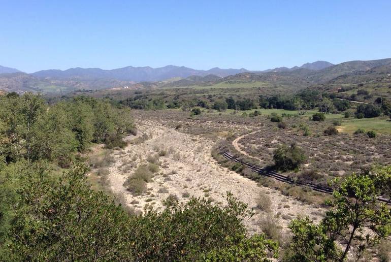
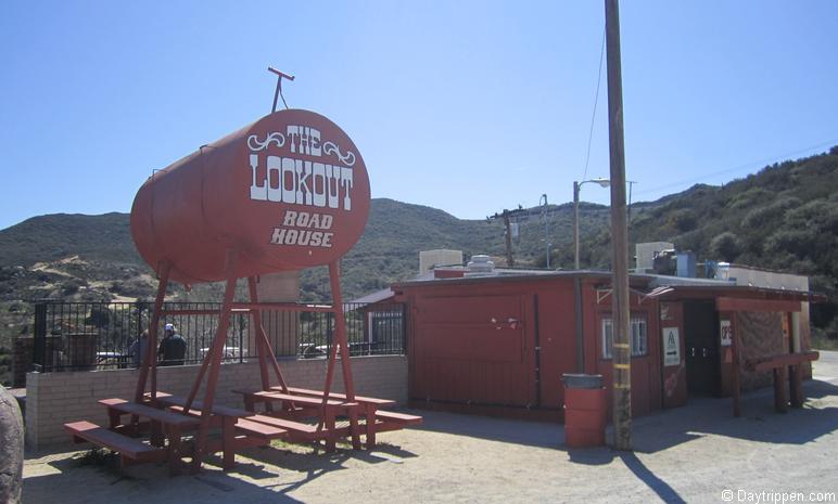
The food at The Lookout is not to be missed. The country breakfast is something I never pass up, especially with the salsa. The owner Barbara still works there pretty much every day and is as friendly as can be. There is a wood fired heater in the front, patio seating and port-a-potties outside.
There’s no charge for parking and taking in the view, but I know just buying a soda or something small helps keep things running, along with using the garbage can.